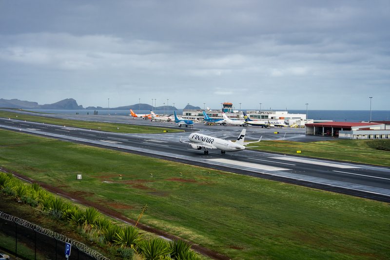
Winds Clamp Down on Madeira: Around 70 Flights Cancelled as “Regina” Keeps Runway 05/23 on the Edge
Madeira’s Cristiano Ronaldo International Airport — better known to most crews and passengers as Funchal (FNC) — saw severe disruption for a second consecutive day on Tuesday, March 3, 2026, with around 70 flights cancelled as strong winds tied to Depression Regina continued to hammer the island.
According to airport operator ANA, operations briefly reopened during a short lull in the morning, but only in a narrow window. Between 07:42 and 09:44 local time, just five arrivals and two departures managed to operate before conditions deteriorated again.
The day before (Monday, March 2), cancellations were even heavier — roughly 90 flights were scrapped, affecting thousands of passengers, including both tourists and Madeiran residents trying to reach the mainland or return home.
Read our stories in your inbox
Two aviation newsletters. Zero fluff.
Why FNC is uniquely vulnerable when the wind swings north/northwest
FNC is one of Europe’s most technically demanding commercial airports when crosswinds build. The runway — 05/23, 2,781 meters — sits on a dramatic platform partly supported over the ocean, with terrain and wind behavior that can change rapidly across the final segment of the approach.
When winds blow from the north to northwest, FNC can see strong crosswind components and localized turbulence near the runway environment. For crews, that often translates into:
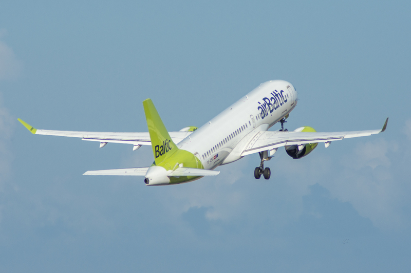
AirBaltic Expands Winter Network with New Destinations Across Europe and North Africa
-
tighter crosswind and gust limits being reached quickly (especially for higher tailwind/crosswind combinations),
-
an increased likelihood of go-arounds,
-
longer holding patterns while crews wait for a brief improvement,
-
and diversions when the numbers simply don’t work.

Even highly capable aircraft — typical Madeira visitors like the Airbus A320 family and Boeing 737 variants — can be forced to abandon an approach when the gust spread or lateral component exceeds operating limits. That’s not a “pilot skill” story; it’s a certification and safety margin story.
The meteorology: orange warning and gusts into triple digits
Portugal’s meteorological institute, IPMA, kept an orange warning in effect for much of the Madeira archipelago as Regina drove strong north to northwest winds. Forecast gusts reached up to 95 km/h, and in higher terrain up to 120 km/h — conditions that can create unpredictable wind shear and rapid shifts on approach.
The warning was expected to run into early Wednesday (March 4), with maritime conditions also deteriorating due to large waves — a factor that matters because when flights divert, the “backup plan” for some travelers becomes ferries or coastal sea connections, which can also be constrained.

What “70 cancellations” looks like in practice at a single-runway island airport
A weather day at FNC behaves differently than a weather day at a big mainland hub.
Madeira’s airline schedule is built around waves of arrivals and departures from Europe — often with high passenger loads, limited same-day alternatives, and aircraft rotations that rely on a quick turnaround. When wind cancels one arrival bank, you don’t just lose those flights. You lose the onward departures those aircraft were supposed to operate as well.
That’s why disruption piles up quickly:
-
Aircraft and crews end up out of position (often on the mainland or diverted to nearby alternates).
-
Hotel capacity tightens as stranded passengers stack overnight.
-
Rebooking options shrink because many flights to and from FNC aren’t high-frequency routes — there simply aren’t endless spare seats.
Alternates for diversions can include Porto Santo (PXO) when conditions allow, or mainland airports like Lisbon (LIS) and Porto (OPO), as well as Canary Islands fields such as Tenerife (TFS) or Gran Canaria (LPA) depending on the airline’s operational plan and available parking.
What passengers should do right now
If you’re flying to or from Funchal (FNC) during a wind event like Regina, the best advice is operational, not optimistic:
-
Check your flight status before leaving for FNC. Don’t rely on “it’s showing on time” if the wind is still near limits.
-
Pack essentials in carry-on (medication, chargers, one change of clothes). Diversions and overnight holds can separate you from checked bags.
-
Expect rolling rebookings rather than instant solutions. On island operations, airlines often need to reposition aircraft before they can add recovery flights.
-
Be ready for a same-day diversion scenario. Even if your aircraft departs, the landing at FNC can still fail late in the approach if conditions shift.
When will it improve?
Conditions were forecast to gradually improve from Wednesday morning (March 4) as Regina moves away to the southeast. That should increase the number of usable operating windows for arrivals and departures at FNC, although a subsequent cold front later in the week could bring more rain — and rain combined with gusty winds is rarely friendly to recovery schedules.
Bottom Line
Madeira’s Funchal Airport (FNC) remains one of the most wind-sensitive commercial airports in Europe, and Depression Regina has again proven why. With around 70 cancellations on March 3 following roughly 90 the day before, even brief operational lulls are being used to land and launch only a handful of aircraft before the crosswind limits return.
For travelers, the key is to treat FNC wind disruptions like a network event, not a single delayed flight: cancellations cascade, alternates fill up, and recovery takes time — even after the wind finally eases.
Keep reading FlyMag
Get the Daily Brief in the morning or the Route Watch weekly recap on Fridays. Or both.